Acreage can be deceiving. Two five-acre parcels in Matinecock can feel worlds apart once you account for setbacks, slopes, trees, and easements. If you are considering a multi-acre estate here, you want clarity on what is truly usable so you can site a home, pool, and amenities with confidence. This guide walks you through how to read surveys and records, assess land and vegetation, and evaluate siting options within local rules so you make a smart, low‑risk purchase. Let’s dive in.
Matinecock’s approval landscape
Matinecock sits within Nassau County and the Town of Oyster Bay. That means approvals can involve the Village, the Town, and the County, depending on the issue. You should confirm which agency oversees building permits, septic, driveways, and any tree or grading work for the specific parcel you are evaluating.
Village zoning controls setbacks, height, accessory structures, and lot coverage. These rules determine where a house, pool, guest house, barn, or tennis court can go. Because zoning can vary by parcel and district, start by verifying the current zoning map, the lot’s district, and the exact setback and coverage rules with the Village building and zoning staff.
Sewer and health oversight fall under Nassau County Department of Health. Some estate parcels connect to sewers, while others use private septic systems. Do not assume you can expand bedroom counts or add amenities without verifying sewer availability or septic capacity. County and Town sewer maps and the Health Department will confirm what is possible.
If the property is near the Long Island Sound or mapped freshwater wetlands, state and federal rules may apply. FEMA flood maps identify flood zones and base flood elevations. Parcels in AE or V zones may face elevation or flood‑vent requirements. NYSDEC freshwater wetlands and coastal rules can also affect where and how you build. Always confirm if wetlands or floodplain regulations touch the site before planning improvements.
Read the survey like a pro
A current boundary and topographic survey are your foundation for decision making on a multi‑acre lot. Ask for both and ensure they are recent.
Survey types you need
- Boundary survey: Shows lot lines, total acreage, and metes-and-bounds details with monuments, bearings, and distances.
- Topographic survey: Maps contour lines, spot elevations, swales, high and low points, and visible utilities.
- Combined topo-boundary: Ideal for planning because siting decisions depend on both legal limits and the land’s shape.
Large, irregular estates typically use metes-and-bounds descriptions rather than lot-and-block. Bearings and distances tie the parcel to physical monuments, which a licensed land surveyor should verify in the field when you get serious.
What to look for on the map
- Lot lines and acreage: Confirm total area and note any irregular edges or jogs that affect layout.
- Setbacks and envelopes: Building lines constrain where structures can sit. Look for any notes about height or coverage.
- Easements and rights-of-way: Utility, drainage, access, and shared driveway easements can limit where you place amenities and may require access for others.
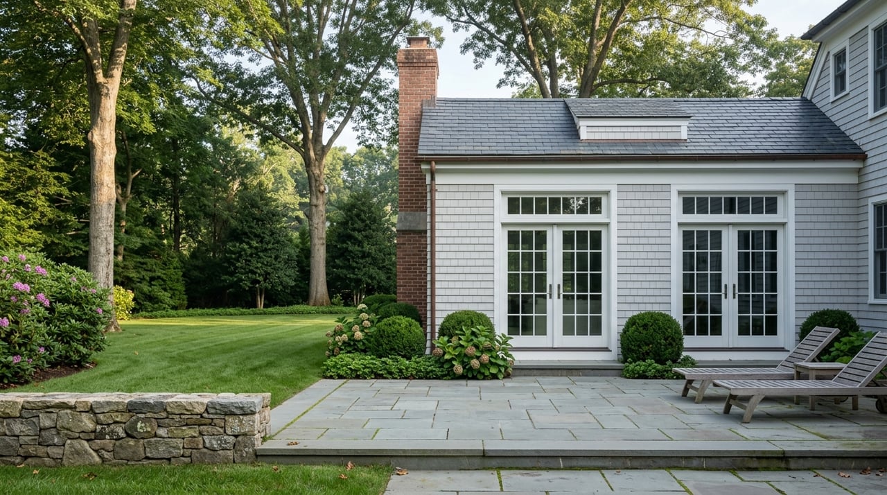
- Existing features: Location of house, sheds, barns, pools, wells, septic tanks and leach fields, and any noted offsets.
- Elevations and contours: Slope steepness and direction inform driveway alignment, foundation design, pool feasibility, and drainage.
- Utilities: Marked overhead lines, transformers, and underground laterals can influence driveway routes and tree preservation.
- Flood and wetlands notes: Many surveys reference FEMA panels and any observed wetlands flags.
Practical reading tips
- Flag easements early. Many prohibit permanent structures and tree planting within the easement area. They can also shape privacy planning if they allow periodic access.
- Verify monuments and corners. Ask a licensed surveyor to confirm boundaries if you will rely on them for siting, fencing, or clearing.
- Use the topo to test ideas. A civil/site engineer can overlay a concept plan for a house, pool, drives, and septic to check feasibility before you bid or remove contingencies.
Topography, soils, and drainage
Slope, subsurface conditions, and natural drainage patterns are the biggest drivers of cost and usability on acreage.
- Slopes under roughly 10 percent are generally easier and less costly to build on. Once slopes approach 15 to 20 percent, you may need retaining walls, engineered foundations, and extra erosion control. Pools and level terraces often require more cut and fill on steeper ground.
- North Shore parcels can include shallow bedrock or glacial till. Shallow ledge raises excavation and septic installation costs and may influence well location and driveway design. Where you suspect ledge, a geotechnical investigation is prudent before committing to a build plan.
- Drainage matters. Your grading plan must direct runoff so you do not create erosion or affect neighbors. Larger clearings and tree removal can accelerate runoff, so permits often require erosion controls during construction.
Useful references include a detailed topographic survey, county elevation data, and USGS mapping. To explore regional elevation and contours, the USGS National Map viewer is a helpful starting point.
Soils, septic, and water
Soils on Long Island vary by location. The NRCS provides general soil maps that can help you understand broad characteristics, but site‑specific testing drives septic decisions.
- Septic feasibility: Nassau County Health will rely on percolation tests and soil test pits to size and approve a system. If an existing system serves the property, obtain recent inspection records and verify the number of bedrooms it was permitted to support.
- Upgrades and alternatives: If soils are less permeable, groundwater is shallow, or slopes are limiting, you may need an engineered or advanced treatment system. These systems occupy space and add cost, so you should identify feasible leach field areas early.
- Water: If the property uses a private well, test water quality and well yield. Wells near bedrock or in certain soils can be more complex and costly to install.
For a general soils overview before you invest in testing, review the NRCS Web Soil Survey.
Wetlands and floodplain checks
Parcels near the Sound, streams, or lowlands can be affected by state and federal rules that limit disturbance and establish setbacks.
- FEMA flood zones: Check whether the lot touches AE or V zones and note base flood elevations. Construction in these zones may require elevation, flood vents, and specific materials. Start with the FEMA Flood Map Service Center.
- NYSDEC wetlands: Mapped freshwater wetlands and their adjacent areas may limit clearing and grading. On‑the‑ground delineation by a qualified consultant provides the definitive line. You can screen parcels using the NYSDEC Environmental Resource Mapper.
Wetlands and floodplain boundaries are precise only after field verification. Build time into your schedule for jurisdictional reviews and permits where needed.
Trees, vegetation, and privacy
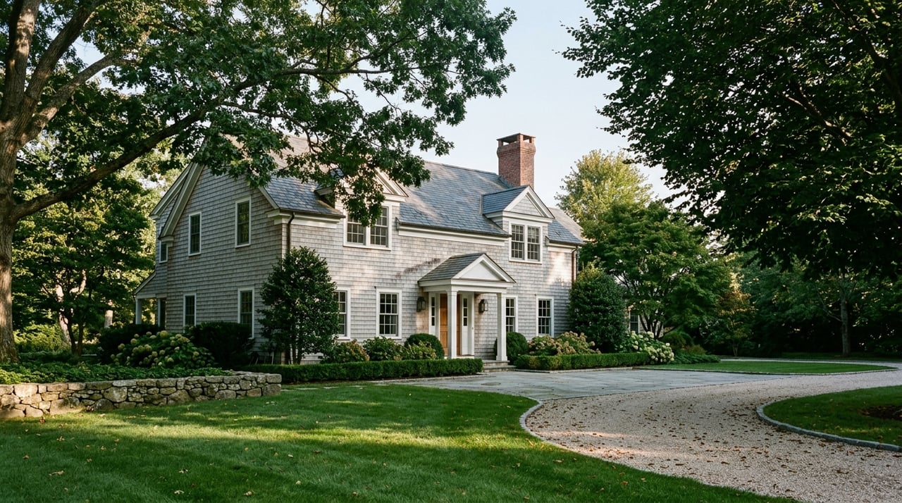
Mature trees contribute to the character and privacy of Matinecock estates. They also add complexity to siting and construction.
- Typical species and character: Many parcels include oaks, beeches, maples, hickories, and established ornamental and evergreen plantings. Evergreens offer year‑round screening, while deciduous trees provide seasonal cover.
- Sightlines and buffers: Walk proposed house and pool locations and study views toward roads and neighboring properties. Evaluate privacy in summer and winter. You can supplement with evergreen belts or strategically placed berms where allowed.
- Root zones and protection: Large trees have extensive root systems. Construction within root zones without protection often damages or kills trees. An arborist can identify high‑value specimens and set protection zones before grading plans are finalized.
- Permits and removal: Some municipalities require permits to remove large or heritage trees and may require replanting. Confirm any local tree ordinances and conservation easements before you plan clearings or view corridors.
Siting homes and amenities
A careful site plan enhances privacy, simplifies maintenance, and avoids costly redesigns.
- Main residence and accessory structures: Verify building envelopes and height limits early. Place the home to work with the grade, not against it. Align the driveway to avoid steep approaches that cause winter maintenance and safety issues.
- Pools, patios, and terraces: Pools need level ground or thoughtful regrading, clear separation from septic systems, and compliance with fencing and setback rules. Plan drainage so hardscapes shed water away from the house and neighboring properties.
- Septic layout: Leach fields must sit on suitable soils, clear of bedrock, and away from seasonal high groundwater. Keep required setbacks from buildings, property lines, wells, and pools. If you anticipate expansion, preserve future expansion area in your plan.
- Wells and utilities: Identify well locations and utility routes early. Overhead electric lines and utility easements can constrain tree planting and drive placement. Undergrounding is possible but can be costly on long runs.
- Private roads and shared drives: Many estates rely on private or shared access. Confirm maintenance agreements, cost sharing, snow removal responsibilities, and any access easements in the title documents.
Costs and timing to expect
On multi‑acre parcels, hidden constraints tend to drive budget and schedule. Shallow ledge excavation, engineered or advanced septic systems, extensive retaining walls, long private driveways, and tree mitigation can each add significant cost. Permitting that involves wetlands, septic approvals, or planning board reviews can add weeks to months, especially when you need seasonal testing or agency meetings.
Build these unknowns into your offer and contract timelines. Many buyers include contingencies for surveys, septic evaluation, and, where relevant, septic upgrade feasibility. A clear site‑planning path before you close reduces risk and surprises.
Due diligence checklist
Use this checklist to organize your evaluation before you remove contingencies:
- Obtain a current boundary and topographic survey showing contours, utilities, and easements.
- Order title commitments and review recorded easements, covenants, and conservation restrictions.
- Confirm village zoning, setbacks, coverage limits, and permit requirements with the Village of Matinecock.
- Confirm sewer availability with Nassau County and Town sewer maps; verify septic oversight with the County Health Department.
- Arrange a septic inspection and schedule perc tests if you expect to add bedrooms or a pool.
- Commission soil and geotechnical borings where slopes, bedrock, or unknown soils are suspected.
- Hire an arborist to inventory specimen trees and create a tree protection plan.
- Screen the property on FEMA flood maps and NYSDEC wetlands mapping; pursue field delineation where needed.
- Confirm electric, gas, and broadband availability and note any utility easements that could affect siting.
- Review shared driveway agreements and maintenance obligations if access is private.
- Ask a civil/site engineer to draft a preliminary site plan to test house, driveway, drainage, pool, and septic layout.
Verify with trusted sources
When you are narrowing options, use these authoritative tools to check parcel constraints:
- Review flood zones and base flood elevations at the FEMA Flood Map Service Center.
- Explore general soil characteristics at the NRCS Web Soil Survey.
- Screen for mapped freshwater wetlands using the NYSDEC Environmental Resource Mapper.
- View regional elevation and mapping in the USGS National Map viewer.
If a parcel looks promising, engage local professionals to produce site‑specific surveys, tests, and plans. That documentation is what agencies will rely on during permitting.
Ready to evaluate acreage with a clear, confident plan tailored to Matinecock? Schedule a private, confidential conversation with Cottie Maxwell to discuss your goals and the next best steps for your search.
FAQs
How do I determine usable acreage in Matinecock?
- Start with the survey’s total acreage, then subtract areas restricted by easements, wetlands or buffers, mapped floodplain, and steep slopes; confirm in the field with a surveyor and engineer.
What if there are easements I cannot see on site?
- Recorded easements should appear in the title commitment and on the survey; ask your attorney and surveyor to verify and request any utility or shared driveway records from the seller.
Will a pool or guest house fit on my parcel?
- Verify the building envelope, zoning setbacks, septic setbacks, and slopes with a topographic survey and a concept site plan from a civil/site engineer before you commit.
How can I gauge year‑round privacy on a wooded lot?
- Walk the property in leaf‑on and leaf‑off conditions, note evergreen screening and sightlines to roads and neighbors, and plan supplemental evergreens or berms where allowed.
What happens if the septic system is undersized or fails?
- Obtain inspection records and consult Nassau County Health on upgrade options; alternative engineered systems exist, but costs and locations depend on soils, groundwater, slopes, and available space.
Do I need permits to remove large trees in Matinecock?
- Check Village code and any conservation easements; many municipalities require permits for removal of large or heritage trees and may require replanting or mitigation.